i-45 Houston
Traffic Maps by Cross Street ...
 
> Allen Parkway
> Cypress Creek Pkwy
> Eastex Fwy
> Fuqua St
> Loop Fwy North Side
> Loop Fwy South Side
> Main St
> NASA Pkwy
> Sam Houston Northside
> Sam Houston Southside
> 5 Hwy
> 10 Hwy
> 69 Hwy
> 610 North Side
> 610 South Side


SEE MORE TRAFFIC MAPS ...


Interstate 45 Houston Traffic
Google


i-45 Houston Traffic ...


On page load traffic map is centered on i-45 at Allen Parkway ...
use elevation controls to zoom map
.


Zoom Traffic to:


> i-45 at Allen Parkway
> i-45 at Cypress Creek Pkwy
> i-45 at Eastex Fwy
> i-45 at Fuqua St
> i-45 at Loop Fwy North Side
> i-45 at Loop Fwy South Side
> i-45 at Main St
> i-45 at NASA Pkwy
> i-45 at Sam Houston North Side
> i-45 at Sam Houston South Side
> i-45 at 5 Hwy
> i-45 at 10 Hwy
> i-45 at 69 Hwy
> i-45 at 610 North Side
> i-45 at 610 South Side

SEE MORE TRAFFIC MAPS ...

SEE ALSO: i-45 Texas ...


About the i-45 in Houston ...


Interstate 45 Houston Map
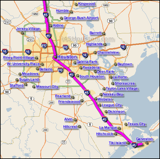
The Interstate 45 in Houston, abbreviated "i-45 Houston",  is one of the major interstate highway routes and traffic corridors that travels generally in a north-south direction across the metro Houston and Harris County area's.

The i-45 travels adjacent to the downtown Houston area, the i-45 generally encircles downtown Houston on it's northern, southern, and western perimeters.

The i-45 is the main route between Houston and the Galveston Island area... the i-45 is also the main route between Houston and Dallas.

The map above shows the i-45 in Houston (highlighted in pink) where the i-45 travels through the Greater Metro Houston area.

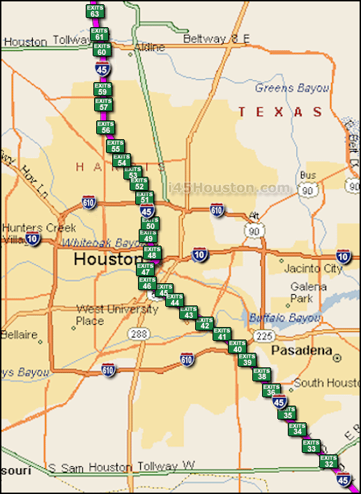
The map below shows approx. locations of various Exit Ramps located along the i-45 in Metro Houston ...
Interstate 45 Houston Exit Map


Disclaimer, Contact, and Privacy Policy.

Copyright i45Houston.com